
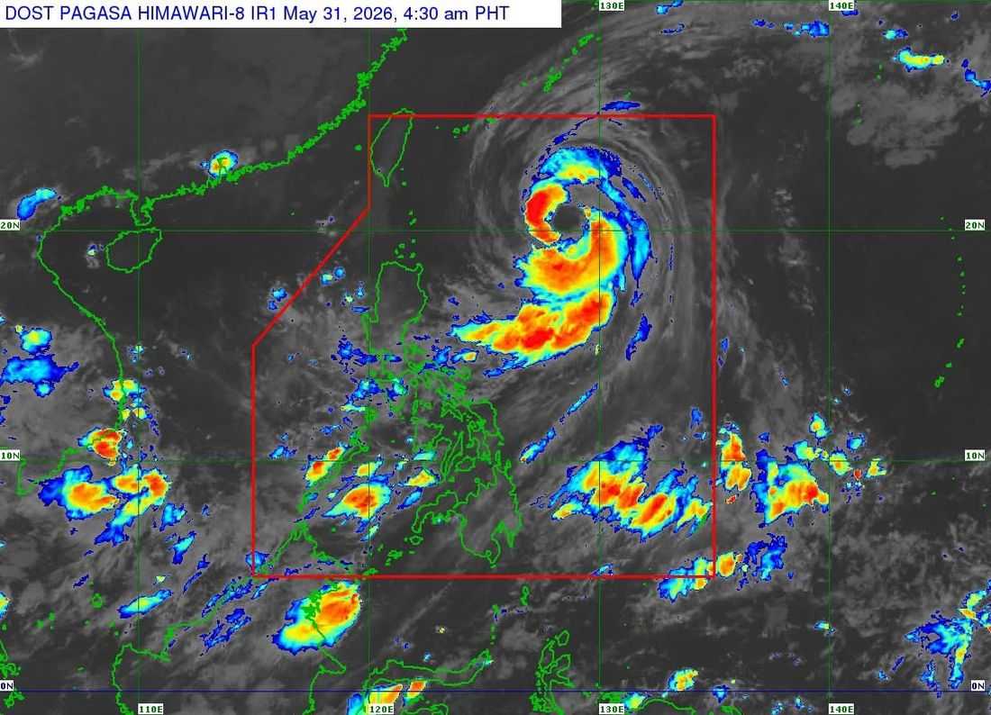
Typhoon Domeng (international name: Jangmi) continued to intensify early Sunday morning as it moved north-northwestward over the Philippine Sea east of Batanes, with the state weather bureau saying the cyclone remains unlikely to make landfall in the country and is expected to exit the Philippine Area of Responsibility (PAR) by Sunday afternoon.
In its 5:00 a.m. Tropical Cyclone Bulletin No. 9 issued on May 31, PAGASA said the center of Typhoon Domeng was estimated at 670 kilometers east of Basco, Batanes as of 4:00 a.m.
The typhoon packs maximum sustained winds of 120 kilometers per hour near the center, gustiness of up to 150 kph, and a central pressure of 975 hectopascals. It is moving north-northwestward at 20 kph.
Despite its strength, PAGASA said no Tropical Cyclone Wind Signal (TCWS) has been raised anywhere in the country, adding that the hoisting of wind signals over Extreme Northern Luzon is now less likely based on the latest forecast track.
Forecasters said Domeng is expected to continue moving north-northwestward until Monday before recurving toward southern Japan. The weather disturbance is forecast to further intensify and reach its peak strength on Monday while remaining over the Philippine Sea.
While direct landfall is not expected, PAGASA warned that the typhoon, together with the enhanced Southwest Monsoon or "Habagat," will continue to bring strong to gale-force winds across several parts of the country.
For Sunday, affected areas include most of the Visayas, Batanes, Cagayan, CALABARZON, MIMAROPA, the Bicol Region, and portions of Mindanao. Strong winds may be particularly felt in coastal and upland communities exposed to prevailing weather conditions.
The weather bureau also advised the public to monitor separate rainfall advisories as the enhanced southwest monsoon may trigger periods of heavy rainfall in several areas.
Meanwhile, rough seas of up to 3.5 meters are expected along the seaboards of Batanes and the eastern coasts of the Babuyan Islands and mainland Cagayan. Small seacraft operators, including motorbanca owners, were advised not to venture out to sea under these conditions.
PAGASA reiterated that hazardous weather conditions, including heavy rainfall and strong winds, may still occur outside the forecast confidence cone and urged local government units and disaster response agencies to remain vigilant.
