
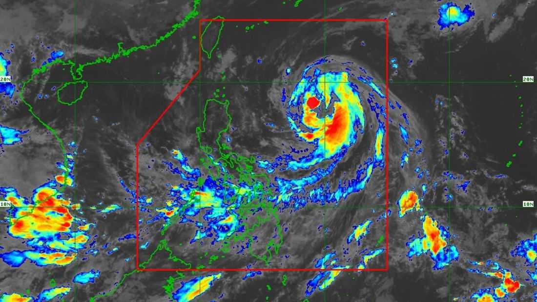
Severe Tropical Storm Domeng may reach typhoon category on Saturday evening (May 30) or Sunday morning (May 31), the PAGASA said.
As of 11:00 AM on Saturday, Domeng slightly intensified while moving northwestward over the Philippine Sea east of Northern Luzon.
Its center was located at 875 km East of Northern Luzon with maximum sustained winds of 100 km/h near the center, gustiness of up to 125 km/h, and central pressure of 985 hPa. It is currently moving northwestward at 20 km/h.
The state weather bureau said Domeng is forecast to move generally northwestward until Sunday before recurving towards southern Japan for the remaining forecast period. However, it noted that the tropical cyclone is less likely to make landfall over the country and will likely exit the Philippine Area of Responsibility (PAR) by Monday (June 1).
Moreover, the severe tropical storm will continue to intensify over the weekend and will steadily weaken. It will remain as a typhoon throughout the rest of the forecast period, the PAGASA said.
In a separate update, the PAGASA announced the start of the southwest monsoon or “habagat” season, signaling the possible onset of the rainy season in the country.
