
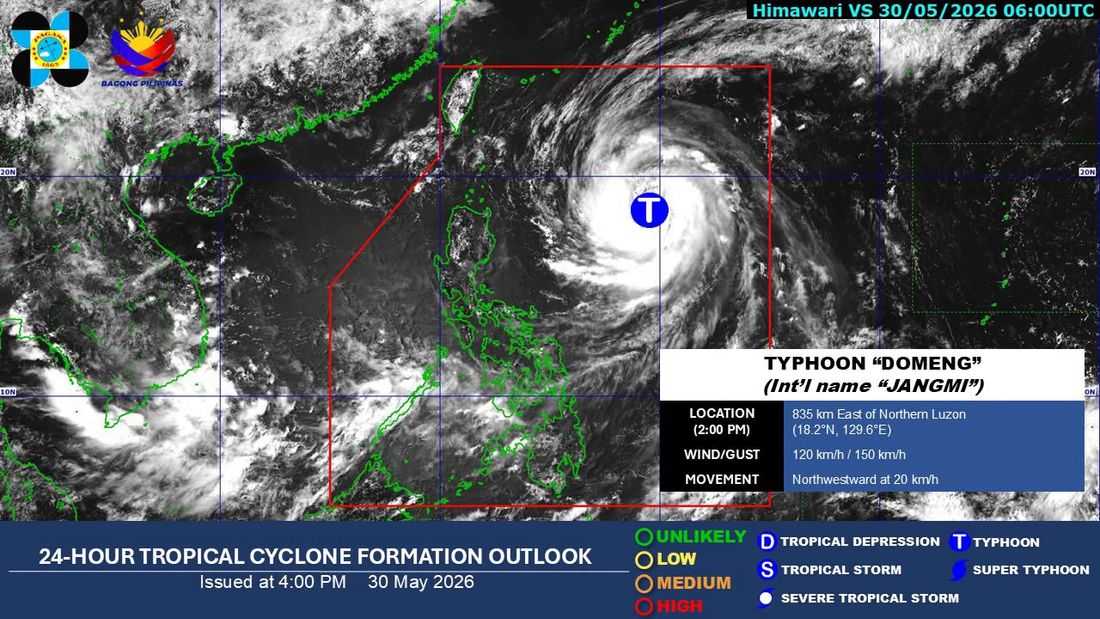
Severe Tropical Storm 'Domeng' intensified into a "typhoon" on Saturday, May 30, according to the Philippine Atmospheric, Geophysical and Astronomical Services Administration (PAGASA).
In its 2 p.m. weather bulletin, PAGASA said Domeng had strengthened into the typhoon category while remaining inside the Philippine Area of Responsibility (PAR).
As of 4 p.m., the center of Typhoon Domeng was estimated at 815 kilometers east of Northern Luzon.
It was packing maximum sustained winds of 120 kilometers per hour near the center and gusts of up to 150 kph, while moving northwestward at 20 kph.
PAGASA said the typhoon is expected to remain far from land and will likely exit PAR on Monday, June 1, without making landfall.
Despite this, the trough or extension of the typhoon is expected to bring scattered rains and thunderstorms over Cagayan Valley, Aurora, and Quezon.
Meanwhile, the southwest monsoon or Habagat, enhanced by Domeng, will continue to affect the western sections of Southern Luzon, Visayas, and Mindanao.
Heavy rains are forecast over parts of MIMAROPA and Western Visayas starting Sunday, with the affected areas expected to expand northward to include Batangas and Bataan by Monday.
PAGASA warned that flooding and landslides may occur in areas experiencing prolonged or intense rainfall.
Under the "typhoon" category, tropical cyclones have maximum sustained winds ranging from 118 to 184 kph.
