
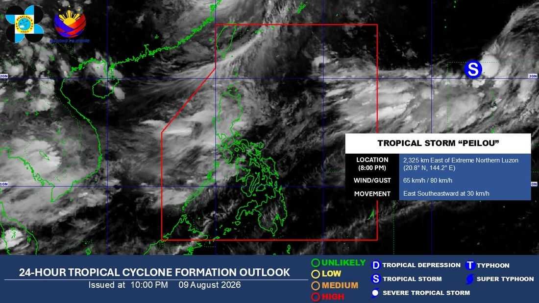
While the chances of Tropical Storm “Peilou” (international name) entering the Philippine Area of Responsibility (PAR) and directly affecting the country are low, it may pull at the Southwest Monsoon or “Habagat,” which will continue to pound Luzon and Visayas, said the state weather bureau.
As of 8:00 p.m., the Philippine Atmospheric, Geophysical and Astronomical Services Administration (PAGASA) said that Tropical Storm Peilou remains outside PAR.
As of its 5:00 p.m. weather update with weather specialist Charmagne Varilla, the storm was sighted 2,200 kilometers East of the extreme northern portion of Luzon.
The storm packed winds reaching 65 kilometers per hour (km/h) and a gustiness of up to 85 km/h. It was moving East Southeastward at a speed of 25 km/h.
“Base sa nakikita natin na scenario, ito nga nasabi nating bagyo ay mababa ‘yung tsansa na pumasok sa ating PAR at makaapekto sa alinmang bahagi ng bansa, ngunit sa mga susunod na araw, posibleng ito ‘yung hihila sa Habagat na siyang patuloy na makakaapekto sa Luzon at Visayas,” Varilla reported.
As of 11:00 p.m., PAGASA issued a red rainfall warning (>200 mm) for Benguet, and an orange rainfall warning (100-200 mm) Ilocos Sur, La Union, Zambales, Bataan, Metro Manila, Rizal, Cavite, and Occidental Mindoro for tonight to tomorrow morning.
Meanwhile, the weather bureau issued a yellow rainfall warning for Ilocos Norte, Abra, Pangasinan, Kalinga, Mountain Province, Ifugao, Nueva Vizcaya, Tarlac, Nueva Ecija, Pampanga, Bulacan, Batangas, Laguna, and Oriental Mindoro.
