The Office of Civil Defense (OCD) has issued a warning over the possible impact of Typhoon Uwan, which is expected to develop into a super typhoon with a massive size exceeding the entire length of mainland Luzon.
According to OCD Administrator Usec. Harold Cabreros, Uwan spans more than 1,000 kilometers wide—significantly larger than mainland Luzon, which measures only about 740 kilometers long and 225 kilometers wide.
"Simula Sabado at Linggo, mararanasan na ang masamang panahon dulot ng bagyong Uwan. Tatahakin nito ang Northern at Central Luzon, pero sa lawak nitong mahigit 1,000 kilometro, dapat ding maghanda ang Metro Manila, Southern Luzon, at iba pang mga rehiyon sa ating bansa," said Cabreros.
"Kaya maging alerto, maghanda, at sumunod sa mga abiso ng awtoridad," he added.
Because of its immense size, Cabreros has placed Metro Manila and several other regions on high alert for possible heavy rains, strong winds, and flooding once the typhoon makes landfall in Northern Luzon.
A State of National Calamity has already been declared ahead of Uwan’s expected arrival, following the devastation left by Typhoon Tino earlier this week.
In the latest report from the National Disaster Risk Reduction and Management Council (NDRRMC), at least 188 fatalities have been recorded, while 135 individuals remain missing due to Tino.
Of the total casualties, 139 were reported from Central Visayas, particularly in Cebu—the hardest-hit province.
Additional deaths were also confirmed in Region VI, the Negros Island Region, Region VIII, and Caraga.
During a situation briefing held at Camp Aguinaldo, President Ferdinand “Bongbong” Marcos Jr. told the media that 10 to 12 regions across the country may be affected by the consecutive onslaught of Typhoons Tino and Uwan.
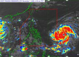
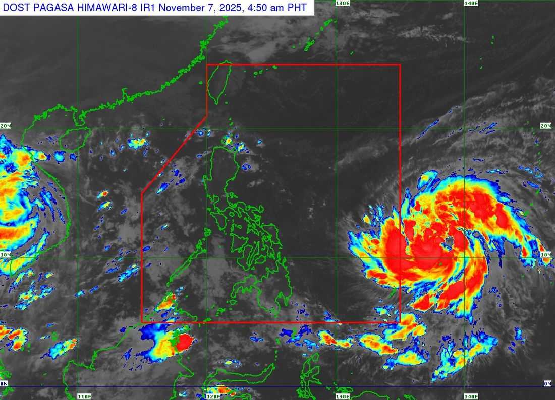
As of 5 a.m. today, Fung-Wong (Uwan), which remains outside the Philippine Area of Responsibility (PAR), has intensified into a severe tropical storm. It was spotted 1,500 kilometers east of Northeastern Mindanao or 1,470 kilometers east of Eastern Visayas, packing maximum sustained winds of 95 km/h near the center, gustiness of up to 115 km/h, and a central pressure of 990 hPa. The storm is moving northwestward at 10 km/h.
There is an increasing chance of landfall on Monday, November 10, over Northern or Central Luzon. The system is forecast to rapidly intensify and may reach typhoon category within the next 24 hours, and possibly super typhoon category by tomorrow evening or Sunday morning. It may also make landfall at or near its peak intensity.
Authorities are urging the public to remain vigilant, monitor weather advisories, and comply with evacuation orders to minimize further loss of life as the country braces for Uwan’s landfall.