The northeast monsoon, or amihan, will continue to affect parts of Luzon, while the easterlies will prevail over the rest of the country on Monday, November 9, the state weather bureau said.
In its 5 a.m. weather forecast, the Philippine Atmospheric, Geophysical and Astronomical Services Administration (PAGASA) said the amihan was currently affecting Northern and Central Luzon, with its effects expected to reach Metro Manila and Calabarzon by Monday afternoon.
The monsoon is expected to strengthen on Tuesday, bringing cooler winds and affecting a larger portion of Luzon, including Metro Manila.
However, PAGASA said the amihan would weaken by Wednesday and Thursday, with its effects likely to be limited to Northern and Central Luzon.
Meanwhile, the easterlies will bring cloudy skies with scattered rain showers and thunderstorms over the Bicol Region, while the rest of Luzon, including Metro Manila, is expected to experience generally fair weather, with partly cloudy to cloudy skies and isolated rain showers.
Residents in Northern Luzon, Central Luzon, Metro Manila and Calabarzon may also feel cooler winds due to the northeast monsoon.
In the Visayas and Mindanao, the easterlies will bring cloudy skies with scattered rain showers and thunderstorms over Davao Oriental, Davao Occidental and the Caraga Region.
The rest of Mindanao and the entire Visayas are expected to experience generally fair weather, although localized thunderstorms may bring sudden heavy downpours.
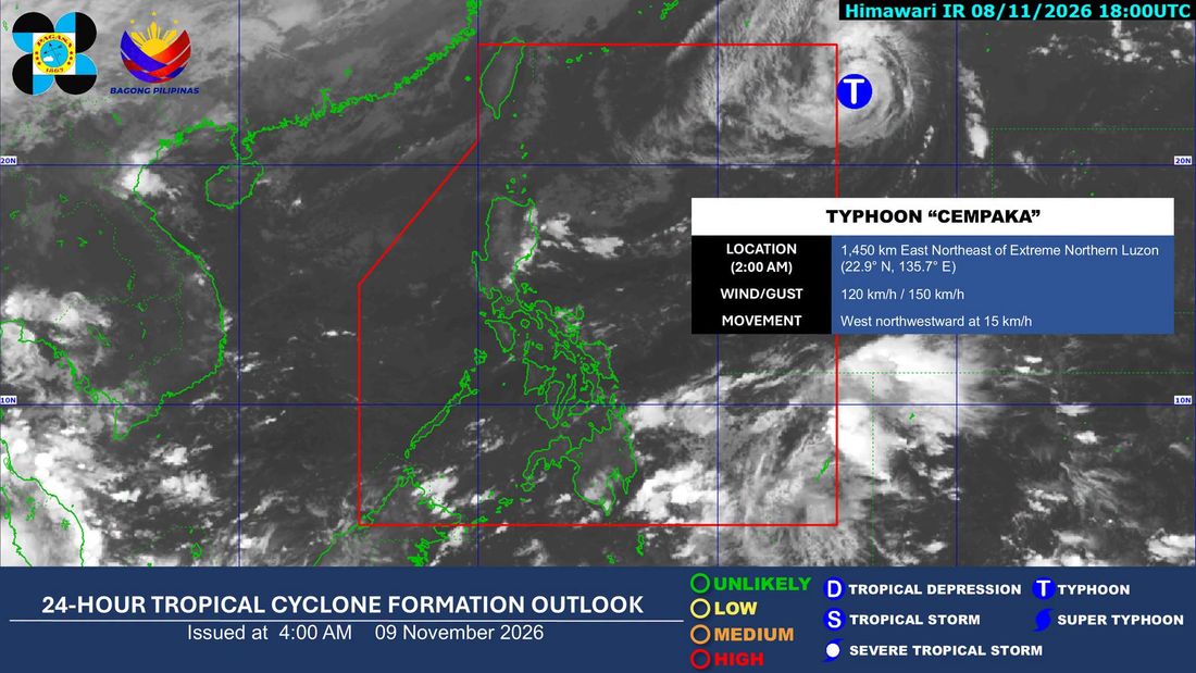
Meanwhile, Tropical Storm Cempaka is gradually approaching the Philippine Area of Responsibility (PAR), with its center located more than 1,400 kilometers east-northeast of Extreme Northern Luzon.
The weather disturbance has maximum sustained winds of 120 kilometers per hour near its center. However, PAGASA said Cempaka was not expected to directly affect the country's weather or make landfall in the Philippines.
Based on its forecast track, Cempaka, which will be named Samuel upon entering the PAR, was expected to enter the Philippine monitoring area on Monday morning and exit by Tuesday. It is forecast to move farther away from the country in the following days.
PAGASA also forecast cloudy skies with rain over Cagayan, Isabela, Quirino, Apayao, Kalinga, Mountain Province, Ifugao, Aurora and Quezon due to the northeast monsoon.
The weather bureau said no gale warning was in effect on Monday but advised fishing communities and small sea vessels in Northern Luzon to exercise caution due to moderate to rough sea conditions caused by the amihan.